|
Повнотекстовий пошук
Пошуковий запит: (<.>I=Ж29144/2016/84<.>) |
Загальна кількість знайдених документів : 1
|
 |
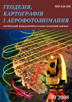
Geodesy, cartography and aerial photography : interdepartmental sci. and techn. rev..- Lviv- Титул.
- Зміст.
- Zvyahina M., Trevoho I., Kostetska J. Geodesic work optimization for determining of water level in the different systems of heights. - C. 5-16.
- Savchyn I., Duma M. Dnister PSPP control GNSS network оptimization. - C. 17-24.
- Tadyeyev О. А. Evaluation of three-dimensional deformation fields of the earth by methods of the projective differential geometry. Rigid rotations of the Earth. - C. 25-38.
- Fys М., Sohor А., Yurkiv М. Elaboration of equipotential surfaces of planets using biorthogonal expansions. - C. 39-43.
- Hrytskiv N., Laykun L., Babiy L. Mapping of avalanche dangerous territories using GIS technologies. - C. 44-55.
- Ivanchuk О., Tumska O. Development and research of technology for automation of the calibration and account of digital SEM images geometric distortion obtained with JCM 5000 (NeoScope) (JEOL, Japan). - C. 56-64.
- Lozynskyi V., Nikulishyn V., Ilkiv T. Technological features of creation of a large-scale topographical plan of Lviv city landfill using combined method. - C. 65-75.
- Hubar Yu. The use of unmanned aerial vehicles for estimating market real-estate value. - C. 76-89.
- Tereshchuk O., Nystoriak I. Efficiency of application of satellite technology when performing land and cadastral works in settlements. - C. 90-100.
- Вимоги до оформлення статей збірника "Геодезія, картографія і аерофотознімання". - C. 101-102.
- Технічні вимоги до оформлення статей збірника "Геодезія, картографія і аерофотознімання". - C. 103-104.
- Journal "Geodesy, Cartography and Aerial Survey" – Requirements for papers. - C. 105-106.
- Journal "Geodesy, Cartography and Aerial Survey" – Technical requirements for papers. - C. 107-108.
| 2016 | | Iss. 84
|
|
|
| 


