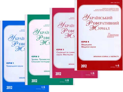
РЕФЕРАТИВНА БАЗА ДАНИХ "УКРАЇНІКА НАУКОВА"
Abstract database «Ukrainica Scientific»


Бази даних


Реферативна база даних - результати пошуку


Вид пошуку
у знайденому
Сортувати знайдені документи за:
авторомназвоюроком виданнявидом документа
 Знайдено в інших БД:Книжкові видання та компакт-диски (822)Журнали та продовжувані видання (310)Автореферати дисертацій (29)Наукова періодика України (1)
Пошуковий запит: (<.>U=Д17$<.>)
Загальна кількість знайдених документів : 808
Представлено документи з 1 до 20
...
1.

Кузик З. 3D-моделювання та візуалізація монументальних споруд за даними аерознімання та ГІС // Сучас. досягнення геодез. науки та вир-ва : зб. наук. пр. Зах. геодез. т-ва УТГК. - 2018. - Вип. 1.
2.

Trevoho I. Aerial data application for construction of large-scale plans // Сучас. досягнення геодез. науки та вир-ва : зб. наук. пр. Зах. геодез. т-ва УТГК. - 2018. - Вип. 1.
3.

Gongwen Xu An image retrieval and semantic mapping method based on region of interest // Наук. вісн. Нац. гірн. ун-ту. - 2015. - № 6.
4.

Abdallah R. Assessment accuracy of the topographic raster maps - Iraq // Сучас. досягнення геодез. науки та вир-ва : зб. наук. пр. Зах. геодез. т-ва УТГК. - 2015. - Вип. 1.
5.

Chabaniuk V. Atlas solutions framework as a method of the renewed model-cognitive conception of cartography // Укр. геогр. журн. - 2021. - № 3.
6.

Chabanyuk V. Cartographical patterns as the means of big data handling in atlas mapping // Сучас. досягнення геодез. науки та вир-ва : зб. наук. пр. Зах. геодез. т-ва УТГК. - 2015. - Вип. 1.
7.

Sossa R. Cartometric investigation of the accuracy plan of Lviv in 1894 // Geodesy, Cartography and Aerial Photography : міжвід. наук.-техн. зб. - 2022. - Вип. 95.
8.

Krakovskyi S. Classification of interactive functions of the electronic atlas: logical scheme and outcomes // Укр. геогр. журн. - 2022. - № 3.
9.

Chetverikov B. Determination of boundaries of ancient burial places using the archived aerial and cartographic materials // Сучас. досягнення геодез. науки та вир-ва : зб. наук. пр. Зах. геодез. т-ва УТГК. - 2016. - Вип. 1.
10.

Rodriges Zalipynis R.A. Efficient isolines construction method for visualization of GRIDDed georeferenced data. — 2011 // Наук. пр. Донец. нац. техн. ун-ту. Сер. Пробл. моделювання та автоматизації проектув.
11.

Mukhina M. P. Expert estimations for informativeness and recognition of selected terrain // Електроніка та системи упр.. - 2016. - № 4.
12.

Burshtynska Kh. V. Hydrological processes modeling using GIS ARCGIS and module HEC-RAS // Geodesy, Cartography and Aerial Photography : міжвід. наук.-техн. зб. - 2020. - Вип. 91.
13.

Burshtynska K. V. Influence of geological structures on the nature of riverbed displacements for the rivers of the Dnister basin upper part // Геодинаміка. - 2019. - № 2.
14.

Kuplovskyi B. Ye. Influence of local seismotectonic and engineering-geological conditions on seismic danger of territories (exemplified by a construction site in Uzhgorod City) // Geodynamics. - 2020. - № 1.
15.

Karpinskyi Yu. INSPIREID implementation in the topographic database of the main state topographic map of Ukraine // Geodesy, Cartography and Aerial Photography : міжвід. наук.-техн. зб. - 2020. - Вип. 91.
16.

Rudenko L. Interactive maps of potentially dangerous objects of Ukraine: problems of database construction and visualization // Укр. геогр. журн.. - 2019. - № 4.
17.

Holubinka Yu. Investigation of the accuracy of plans of Lviv in 1844 and 1931 // Геодезія, картографія і аерофотознімання : міжвід. наук.-техн. зб. - 2018. - Вип. 88.
18.

Celms A. Justification of the height models available in Latvia // Сучас. досягнення геодез. науки та вир-ва : зб. наук. пр. Зах. геодез. т-ва УТГК. - 2019. - Вип. 2.
19.

Wysocki J. Kataster trojwymiarowy (3D) i numeryczne modele terenu w urzadzaniu obszarow niezurbanizowanych // Геодез., картогр. і аерофотознімання : укр. міжвід. наук.-техн. зб. - 2007. - Вип. 68.
20.

Mikhalyov O. I. Large cities road traffic self-similarity research // Систем. технології. - 2018. - № 6.
...
 
Національна бібліотека України імені В. І. Вернадського
Відділ наукового формування національних реферативних ресурсів
Інститут проблем реєстрації інформації НАН України

Всі права захищені © Національна бібліотека України імені В. І. Вернадського