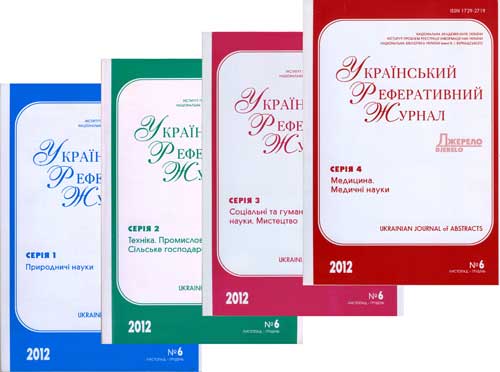
РЕФЕРАТИВНА БАЗА ДАНИХ "УКРАЇНІКА НАУКОВА"
Abstract database «Ukrainica Scientific»


Бази даних


Реферативна база даних - результати пошуку


Вид пошуку
у знайденому
Сортувати знайдені документи за:
авторомназвоюроком виданнявидом документа
 Знайдено в інших БД:Книжкові видання та компакт-диски (116)
Пошуковий запит: (<.>U=Д88$<.>)
Загальна кількість знайдених документів : 145
Представлено документи з 1 до 20
...
1.

Kuznichenko S. A fuzzy approach for determining the cognitive spatial location of an object in geographical information system // Eastern-Europ. J. of Enterprise Technologies. - 2021. - № 6/9.
2.

Grama V. Assessment of environmental conditions within the limit of the riparian water protection strips using the WebGIS technology // Geodesy, Cartography and Aerial Photography : міжвід. наук.-техн. зб. - 2020. - Вип. 92.
3.

Drobaha G. Construction of the expert system of geospatial analysis that employs scenarios for the automated data generation for a digital map // Вост.-Европ. журн. передовых технологий. - 2019. - № 3/2.
4.

Marchenko A. N. Determination of the horizontal strain rates tensor in Western Ukraine // Геодинаміка. - 2019. - № 2.
5.

Koshlan A. Development of an algorithm for complex processing of geospatial data in the special-purpose geoinformation system in conditions of diversity and uncertainty of data // Вост.-Европ. журн. передовых технологий. - 2019. - № 5/9.
6.

Koshlan A. Development of an algorithm for complex processing of geospatial data in the special-purpose geoinformation system in conditions of diversity and uncertainty of data // Вост.-Европ. журн. передовых технологий. - 2019. - № 5/9.
7.

Sarinova A. Development of compression algorithms for hyperspectral aerospace images based on discrete orthogonal transformations // Eastern-Europ. J. of Enterprise Technologies. - 2022. - № 1/2.
8.

Celms A. Development of Implementation of geoinformation provision of state border demarcation works // Сучас. досягнення геодез. науки та вир-ва : зб. наук. пр. Зах. геодез. т-ва УТГК. - 2018. - Вип. 1.
9.

Dvulit P. Diagnosis of metrological characteristics of high-precision GNSS observations by methods of non-classical error theory of measurements // Geodesy, Cartography and Aerial Photography : міжвід. наук.-техн. зб. - 2021. - Вип. 94.
10.

Zabielin S. I. Forecasting SO2 emission of Kilauea volcano using intelligent method of data analysis // Систем. дослідж. та інформ. технології. - 2019. - № 4.
11.

Lazorenko N. Integration of geospatial data based on the application of the JOIN operation of relative algebra // Geodesy, Cartography and Aerial Photography : міжвід. наук.-техн. зб. - 2022. - Вип. 95.
12.

Pronin S. Overview of Python libraries for analysis geographical data // Вісн. ХНАДУ : зб. наук. пр. - 2021. - Вип. 92, т. 1.
13.

Boyko O. Prerequisites for the integrated geoinformation systems implementation for spatial planning of airport complexes // Вісн. Нац. авіац. ун-ту. - 2018. - 77, № 4.
14.

Hrytskiv N. Research of spatial location sanitary protection zones of industrial enterprises using methods of geoinformation modeling // Geodesy, Cartography and Aerial Photography : міжвід. наук.-техн. зб. - 2022. - Вип. 95.
15.

Tvoroshenko I. S. Software determination of the optimal route by geoinformation technologies // Радіоелектроніка. Інформатика. Управління. - 2019. - № 3.
16.

Perovych I. Technology of optimal site selection for solar photovoltaic power plants using GIS and Remote sensing techniques // Геодезія, картографія і аерофотознімання : Укр. міжвід. наук.-техн. зб. - 2017. - Вип. 86.
17.

Тревого І. Інноваційні цифрові та ІТ-технології на "INTERGEО-2017" // Сучас. досягнення геодез. науки та вир-ва : зб. наук. пр. Зах. геодез. т-ва УТГК. - 2018. - Вип. 1.
18.

Попов М. О. Інтегрування гетерогенних геопросторових даних на основі теорії свідчень Демпстера - Шейфера // Мат. машини і системи. - 2019. - № 3.
19.

Попов М. О. Інтегрування гетерогенних геопросторових даних на основі теорії свідчень Демпстера - Шейфера // Мат. машини і системи. - 2019. - № 3.
20.

Семенчук М. Р. Інтерполяція за методом нерегулярної тріангуляційної мережі у просторовому аналізі // Зв'язок. - 2022. - № 2.
...
 
Національна бібліотека України імені В. І. Вернадського
Відділ наукового формування національних реферативних ресурсів
Інститут проблем реєстрації інформації НАН України

Всі права захищені © Національна бібліотека України імені В. І. Вернадського